The Dorset walk 1: Corfe Mullen and Upton Heath
Matt Wilkinson and Andy Farrer skirt the western edge of the conurbation
Published in June ’16
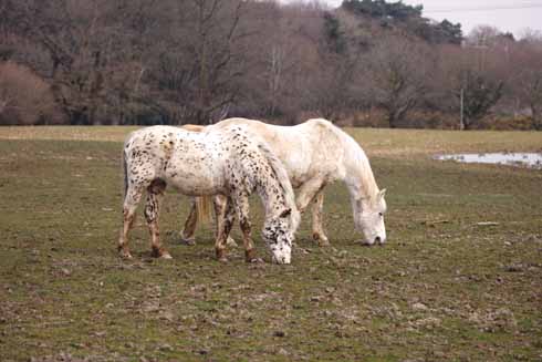
Pastoral scenes early on the second section of the walk
Think of countryside and you probably think of those areas of our county which are primarily agricultural and where you can walk for miles, seeing hardly a sign of human habitation. But there is real and rewarding countryside close to the centres of population, as this walk proves.
Corfe Mullen forms the western edge of the great East Dorset conurbation that stretches to Highcliffe and the county boundary; the village’s devotees might dispute this statement, but it runs seamlessly into Broadstone, which runs into Poole.
However, as it is on the outer edge, it enjoys the proximity of a rural landscape, although the animals in the fields are more likely to be horses than cows or sheep and there are reminders of humanity (the hum of traffic, homes glimpsed through trees, fly-tipping and pylons), but much of the route qualifies as a genuine country walk.
Nowhere is this more true than on Upton Heath: 500 acres of wilderness that thrusts into the corner formed by Upton, Corfe Mullen and Creekmoor. Much of it is a formal nature reserve, managed by the Dorset Wildlife Trust and an ideal habitat for flora (heathers) and fauna (reptiles). There are signs of historical exploitation for clay and sand, but today the main threat comes from litter, fire, habitat destruction and the other hazards that are inescapable in a wild area so close to housing. A volunteer organisation called Heathwatch was founded after a disastrous fire in 2011 to minimise these hazards, and the idea has spread to other areas of the East Dorset heaths.
Distance: About 5½ miles
Terrain: There are a few short climbs on Upton Heath, where some of the sandy patches make for heavy going underfoot, but overall this is not a demanding route.
Start: The parking area to the south of Springdale Road, Corfe Mullen. OS reference SY987958. Postcode BH21 3QN (approximately).
How to get there: Turn east off the A350 Poole-Blandford Road at the Limberlost junction, the only traffic lights between the A35 and the A31. Continue for 1¼ miles to a mini-roundabout, where turn right into Springdale Road. The parking area is in about 350 yards on the right.
Maps: OS Explorer 118 (Shaftesbury & Cranborne Chase); OS Landranger 195 (Bournemouth & Purbeck).
Refreshments: The Holme Bush Inn.
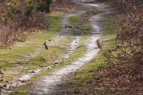
There’s wildlife aplenty on display along the way
THE WALK
1. Walk directly away from Springdale Road on a clear path through the trees and undergrowth. In rather over 100 yards, with a gate straight ahead, turn right on a wide track. About 60 yards before reaching a road, turn left down a path, which initially runs under some power lines. At a gate continue straight ahead.
Pass to the right of a radio mast and follow a security fence on the left. At the end of the fence continue straight ahead into a large, sandy open area. Look out on the right for a path that winds down the hill, through a grove of silver birches, to reach a fence. At the fence turn left to reach a junction with another path, with a metal gate on the right. Go through this and walk down to a road.
2. Cross over and walk up the road immediately opposite (Waterloo Road) for just under ½ mile before turning left onto a track, a few yards after Colindeare on the right. Ignore large double gates on the left and take the right fork to continue uphill past Badgers Green. Follow the track as it swings to the right, left, left again and then right again and leads to a lane (Rushall Lane). Turn left on this lane for a little over ½ mile and at the top of a rise, opposite the drive to Forest Hill Lodge East, turn left on a broad track. Continue on this to a road just down from the Holme Bush Inn. Go straight across and up Beacon Hill Lane.
3. After passing the local office of the Dorset Wildlife Trust and the Urban Wildlife Centre on the left, the lane becomes an unpaved track. Continue for nearly ¾ mile to an open sandy area at the bottom of a slope with a wooden fence on the skyline ahead, beyond which can be heard the noise of the A35. Here turn left, parallel to the fence initially, on a sandy track that leads up onto a rise overlooking the dual carriageway. Turn left on a paved lane that reverts to a sandy track. In a further 150 yards follow the track round to the left.
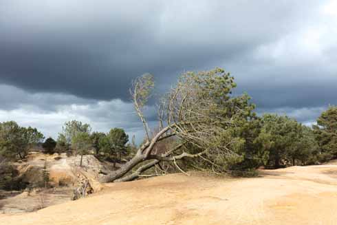
A more dramatic landscape towards the end of the walk
4. In just over ½ mile turn left on a clear track, soon after a metal gate on the right. Fork immediately right on a track which winds over the heath towards three sets of power lines. It crosses under the first set, then bends sharply right and eventually left to cross under the other two. Continue on the track across the heath as it rises gently. After a slight bend to the left then right, it rises more steeply. At the top of this rise, fork left on a path and follow it until a set of steps descend ahead. Here turn right, and in 50 yards left onto a path leading to a stile. On the other side of the stile continue in the same direction into an open grassy area.
5. Walk straight across it and turn left on the other side. At the end of the open area, before woodland, fork right on a path through bushes. Cross a stile and in a few yards reach a T-junction with another path. Turn left, go through a gate, take the right fork, slightly uphill, then stay on the main path as it climbs gently to a large patch of gravel which is the Upton Heath Viewpoint. Lean on the wooden fence to the left to admire the view of Poole, its harbour, the Purbeck Hills and Poole Bay, then go through a metal gate that leads onto a track away from the hilltop. Cross a junction with a wider track and continue straight ahead to return to your car.
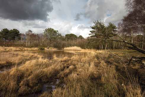
The ponds and trees create a backdrop with impact on the fourth section of the walk


