Old man river: part 3
Roger Guttridge follows Dorset’s primary watercourse from Fiddleford to Sturminster Marshall
Published in February ’16

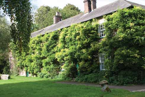
Durweston Mill was saved by its conversion to housing, but whilst the location is idyllic, the exterior was perhaps not aesthetically improved by the conversion exercise
After leaving the historic surroundings of Fiddleford Mill, with its medieval manor house, sixteenth century inscription on the wheelhouse wall and legends of smugglers storing their contraband there, the Stour heads under the footpath that has replaced the railway line to curve around Hammoon. This road to Manston and Child Okeford is historically flood-prone and was frequently impassable in winter until flood prevention work in recent times. Downstream from here, there was presumably once a great oak tree by a ford, the combination of which have given their name to three villages – Child Okeford, Shillingstone (former Shilling Okeford) and Okeford Fitzpaine. Hayward Bridge carries traffic across the river today.
If rivers could talk, how much the Stour hereabouts would have to say about the historic events it has witnessed. On nearby Hambledon Hill’s Iron Age fortifications, Dorset’s famous ‘pitchfork army’ of poorly armed country folk took on Cromwell’s troops in 1645. The Clubmen supported neither King nor Parliament but were fed up with seeing their crops trampled, livestock plundered and women raped during three years of war. The uprising was a disaster with sixty dead and hundreds wounded or captured inside an hour.
Exactly 1600 years earlier, the neighbouring hillfort of Hod Hill was stormed by invading Romans, who went on to build their own camp in the north-west corner.
South of Hod Hill, as it makes its way between Stourpaine and Durweston, the Stour is joined by the River Iwerne. Few spots on the Stour are more picturesque than Durweston Mill, with its large millpond surrounded on two sides by trees and bushes and set against a background of white-painted hatches and a three-storey mill building tastefully converted to four large apartments. The millpond used to be even bigger but silting-up has created an island on its eastern side. The drop from millstream to pond is reputedly the deepest on the Stour.
While the Mill House across the road is Georgian, the former mill building dates from about 1932, when fire destroyed its own Georgian predecessor. As well as a flour mill, it also produced porridge oats during the war and had a spell as an animal feed factory before closing for good in 1969. It later became a boarding house for girls from Croft House School, Shillingstone. The ground floor has been flooded four times since the mill closed, most recently on Christmas Eve 2013.

Durweston Bridge showing the results of a collision between lorry and stone parapet that has been happening to Dorset’s bridges since the invention of the lorry
Durweston Bridge is one of many on the Stour that are regularly attacked by careless drivers, undeterred by the threat of transportation to Australia. This is not a new phenomenon. A picture taken in 1929 shows a lorry perched precariously over the river as a crowd looks on.
Blandford Bridge near the Bryanston Gates
From Durweston, the river sweeps gently between Blandford and Bryanston School, whose rowing facilities would be hard to better. The east bank is densely wooded but on the Bryanston side, spacious playing fields stretch away from the rowing pavilion towards the parish church and the school buildings part-hidden by trees. Downstream, the Stour barely leaves the shadow of Bryanston Woods before passing under the main river bridge, a particularly wide and weedy section of water where, on a warm summer’s day, I saw some mighty chub basking in the shallows. I also counted thirty young mallard above the nearby weir, attracted by the easy pickings thrown by the public at The Ham. At times of flooding, river water has often reached the Crown Hotel. It happened twice in 1979 but flood prevention work has since come to the rescue.
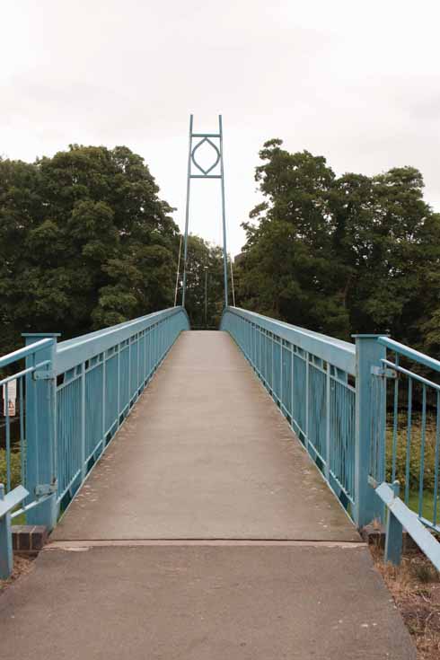
The suspension bridge joining Blandford St Mary with the centre of town
Adjoining the car park is the site of Blandford’s original open air swimming baths, which served the town for several decades from the 1920s. I learned to swim there in the 1960s, gritting my teeth as I slipped gingerly into the bone-chilling water at 9.30 on a May morning. My old PE teacher at Blandford Grammar School, John Paulley, tells me the water temperature occasionally got as low as 47 Fahrenheit (8.3 Centigrade). Occasionally we shared the pool with fish that had become trapped after migrating from the Stour.
The blue Mortain footbridge, opened in 2000 and named after Blandford’s twin town in France, offers a short-cut to Blandford St Mary, where the historic Hall and Woodhouse brewery dominates the skyline alongside business units and a supermarket. Just as the Stour’s arrival at Sturminster Newton is celebrated by the imposing pillars of the old railway bridge, so its departure from Blandford is similarly marked.
East of Charlton Marshall and Spetisbury, the Stour divides itself into three main watercourses, the middle one man-made with sluices to control the flow of water to two neighbouring mills. The three streams effectively create islands and require a series of footbridges of various descriptions. From Clapcotts Farm at Spetisbury, a path leads to one of the Stour’s hidden gems – the longest footbridge on the river (I paced it out at eighty yards), which spans a kind of water garden with ponds, lawns, millstream and waterside plants. The area is a designated Site of Nature Conservation Interest and seventy-seven bird species have been seen here not to mention fish and mammals, including otters.
The River Stour at Spetisbury
Beyond the bridge is the site of Spetisbury Mill, mentioned in the Domesday Book but sadly destroyed by fire in 1880. The Old Mill House survives next to the hatches and millpond while the site of the millworkings is now occupied by a bed and breakfast annexe and garages. On certain days you can find a ‘pop-up café’ in the grounds of the Old Mill House not to mention a nearby farm shop and ‘trading post’ for home produce.
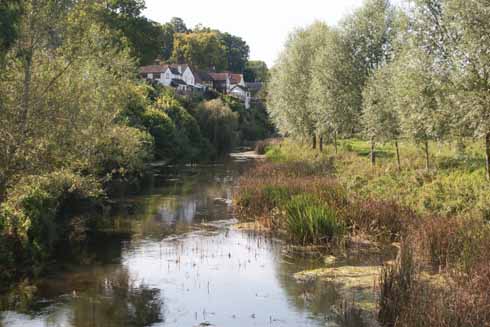
Near Spetisbury
Beyond Spetisbury Mill, a footpath and four more bridges lead to Keynston Mill, now a private residence, which has also been a pick-your-own fruit and vegetable farm in recent times. Despite its name, this mill is nearer Tarrant Crawford than Tarrant Keynston. On the bridge at Keynston Mill, I met Spetisbury resident and Dorset Life subscriber Sue Grew, who told me of when they used to take a punt on the river here. ‘The most dangerous thing was the swans,’ she said. I spotted a kingfisher here and, minutes later, a second one perched on a branch above the River Tarrant, which joins the Stour upstream from Spetisbury.
Keynston Mill, now a private residence
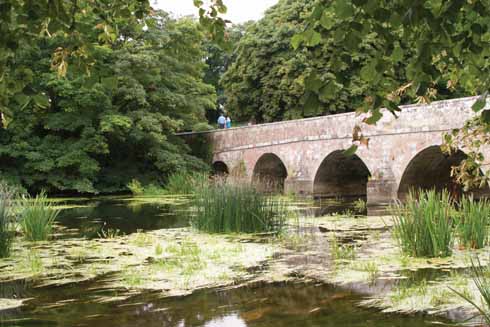
Approaching Spetisbury’s Crawford Bridge, several properties occupy the high ground on the north-east bank. Just before the bridge, a large island divides the river and a notice warns that fishing from there is ‘private’. The bridge itself has twelve arches spanning a particularly wide stretch of river and flood plain.
Shapwick parish church sits almost on the riverbank – ‘too near for comfort’, says Monica Hutchings. It’s a picturesque setting but not without its problems. Floodwater has been known to wash skeletons from graves in the churchyard while in 1870 a coffin and its cargo floated away in the floods, never to be seen again. In the same era two young girls fell through ice and drowned while skating and are remembered by an inscription on the font. At the church gate and adjoining car park, two heavy-duty iron flood barriers on rails stand ready to be rolled into place to protect the village from rising waters. As the floodwater comes up through the hedges, it ‘sounds like soldiers marching,’ one resident told me.
Parts of Sturminster Marshall, the next village downstream, also have a history of flooding. In 1979 I found myself up to my knees in water as I covered floods for the Bournemouth Evening Echo. As at Hammoon and Blandford, the problem has since been alleviated by prevention work.
Connecting the parishes of Shapwick and Sturminster Marshall is White Mill Bridge, arguably the most beautiful in Dorset, probably the oldest and certainly the finest of Norman construction. It was built about 1175 and its eight arches are best viewed from the meadow on the south-west bank downstream. The bridge was once on the main road between Dorchester and Wimborne but lost its principle purpose in 1636, when Wimborne’s Julians Bridge was built to provide a more direct route. The change was White Mill Bridge’s salvation, as it was able to remain close to its original form instead of being widened to accommodate twentieth century traffic – although the weight of traction engines had begun to widen it before they were banned from the bridge in 1909.
The bridge is built on wooden foundations, its heavy stone buttresses supported by rafts of oak and those in turn by oak piles sunk into the riverbed. Bridge engineers uncovered the foundations after flood damage in 1964. They replaced the rafts with concrete but the piles – perfectly preserved for 800 years by oxygen starvation – were allowed to remain.

Perhaps the most easily recognisable mill on the Stour – thanks to its dovecotes – is White Mill, near Sturminster Marshall
The location is also associated with the legend of Knowlton bells. Centuries ago, when Knowlton church – beside the Wimborne-Cranborne road – was disused, but not yet a ruin, the people of Sturminster Marshall saw it as the answer to a prayer – for Knowlton had bells and their church needed them. One dark night they crept across the downs and claimed their prize. But the loss was soon discovered and, as the bell thieves neared their home village, they heard the Knowltonians gaining ground behind them. In their panic they tipped the bells into the river near White Mill Bridge, intending to retrieve them later. They tried, more than once, but the bells always slipped back in… or so the story goes.
Like many of the Stour’s mills, White Mill itself is mentioned in the Domesday Book, although the present building dates from 1776. It was extensively restored in 1994 and retains its original apple- and oak-wood machinery, although this is now too fragile to use. After the dam burst in 1865, White Mill’s focus shifted from milling to farming and baking. It was also the birthplace of the writer, artist, angler, naturalist and banker H S Joyce (1882-1961), whose family milled and farmed there from the 1550s until the early 1900s. Harry Joyce wrote for many of the leading magazines of his day and his seven books included I Was Born in the Country (1946), an account of his childhood on the banks of the Stour and beyond. I edited this for a new edition, published in 2000 under the title A Country Childhood. ◗


