The Dorset walk 2 – Godlingston Heath
Teresa Ridout on a walk with spectacular views and some of the country's rarest ecosystem
Published in July ’14
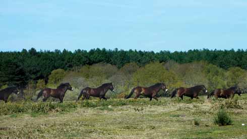
The rapid decline of heathland has been an ongoing issue of huge concern; since the 19th century, approximately 85% of Dorset’s heathland has been lost, leaving fragmented areas of heath across the county. Managed by the National Trust, Godlingston Heath is one of the largest lowland heath areas in the UK. The area where it is found, between the Purbeck Ridge and Poole Harbour, is a gem in Dorset’s crown, and, because it provides a protected and varied habitat ranging from dry heath to bog, it attracts all six species of British reptile as well as many other types of wildlife.
Heathland landscape is not natural, but results from the clearance of the established woodland by settlers who, over 4000 years ago, moved to the land around Poole Harbour. The soil was sandy and already nutrient poor but the clearance of woodland led to the soil becoming even more acidic and therefore the number of species that it could support became limited – heather, gorse and bracken became the established plants but these were put to good use as they provided the settlers with materials for thatching, bedding, fodder for animals and the boggy areas supplied peat for warmth. Today without regular land management heaths are threatened by urban settlement and coniferous woodland.
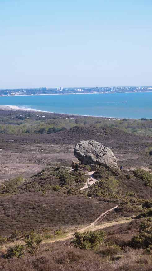
A look at this area on an Ordnance Survey map reveals features which bear witness to prehistoric man’s activity in the area; there are tumului and barrows and rising up over the heath on the top of a small hillock is an enormous boulder – the imposing and mysterious Agglestone Rock. Sadly, despite a variety of intriguing folk tales, it is in fact the geologists that provide the real explanation for this dominating feature on the deserted heath land.
The name of the Adlingstone or Agglestone is variously said to derive from aethling and stan meaning ‘Prince’s Stone’, from the Saxon haligstand, meaning holy stone or possibly witch’s stone, or hagolstan, Old English for hailstone. It is made of hard ironstone (iron-rich sandstone), reputedly weighs about 500 tons and was once a pedestal rock topping a mount between two valleys where it endured for thousands of years, however the strata below and around it has gradually eroded leading to a shift in its position in 1970 when it moved from a flat anvil appearance to its current tilt. The slopes surrounding the rock are constantly altering as they are washed away by rain leaving channels and paths which are full of coarse sandy debris. On a nearby hill to the west of Agglestone is the less spectacular Puckstone (goblin’s stone) a similar but smaller piece of rock on a lower summit.
Distance: 4 miles
Terrain: Tracks over heathland – uneven and can be muddy in places after wet weather.
Start: B3351 Corfe Castle to Studland – on the left ¼ mile after the entrance to the Isle of Purbeck Golf Club
Parking: Lay-by – limited parking
Refreshments: None on route
Maps: OS Outdoor Leisure 15 – Purbeck and South Dorset (NB even recent maps are not brilliant for showing woodland in the right place)
THE WALK
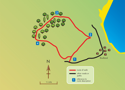
This walk encompasses breathtaking views across Godlingston Heath to Little Sea and Studland Bay, passing the Agglestone, which stands out as a prominent feature in the landscape from wherever you view it.
1 From the lay-by go through the gateway and follow the track as it slopes downhill. After a short distance the track opens out and the Isle of Purbeck Golf Club buildings can be seen in the distance on the left. Continue to follow the path and the route is soon marked by a stone way-marker which indicates Agglestone and Studland Heath straight on. The track is very clearly marked and quite wide at this section and there is another stone marker quite soon this time indicating Agglestone and Studland Heath straight on and Rempstone to the left – take the route to Agglestone. There are exceptional views across Poole Harbour at this point. The path becomes quite sandy and the next stone marker on the left of the track directs left to Agglestone and Studland Heath. Follow the path downhill towards and then through a gateway, looking out for the next stone marker which is a National Trust sign indicating the track to Agglestone. Follow the path and the Agglestone is very soon clearly in sight.
2 On the far side of Agglestone Rock follow a sandy path downhill towards a wooden bridge which crosses a boggy patch and the path then climbs on wooden steps. It is possible to take a short cut at the next marker post on the left of the path or continue straight on and enter a slightly wooded area until reaching a ‘T’ junction which is marked with a wooden marker sign, turn left and continue the track as it rises up hill. Continue along the clearly marked track with Agglestone and Godlingston Heath on the left and views across Studland Heath towards Poole Bay on the right. The path is now heading towards a wooded area; follow the signpost in the middle of this green path which point towards Greenland. On approaching the wooded area the path is not clearly marked but it is necessary to veer to the right until a gateway comes into view.
3 Go through the gateway and turn left, indicated on the signpost to Rempstone. Pass through a second gateway and follow the path down a short slope and across a ford – there is a small bridge on the left of the track. The path then rises up a short slope onto a wider track, take the left-hand fork. The route continues clearly on a gravel track – do not deviate onto any smaller side tracks and keep Newton Heath Plantation on the right. Continue as the track rises briefly through a coniferous area before descending until the track flattens out and then turn left just after a rusty farm tank, follow the stone way markers which indicate bridleway.
4 The route now continues along the northern edge of the golf course; the way markers indicate Studland and Agglestone, continue to follow this route keeping the green on the right hand side before entering back onto heathland. On reaching the stretch of track where the Club House building is on the right, cross what appears to be a wider main track (not a public footpath – for the use of golfers only) and continue to the next section of heath and the golf green is once more on the right hand side. Finally meet back with the stretch of bridleway where the walk began and turn right towards the lay-by. ◗


