Dorset as you’ve never seen it
Bournemouth University's Andy Ford explains how luridly coloured Airborne Laser Scanned pictures of Dorset can help us to understand our county better
Published in February ’14
We are used to looking at the world from around 1.5m above the level we are on. Our binocular vision helps us to understand what we are looking at and how each element relates to the others. From a photographic point of view, we are also able to take pictures from above, but whilst these sometimes give us more information, they are flat and, from a scientific point of view, that flatness renders them near to useless.
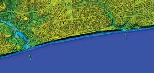
- The relative heights of the buildings (the red ones are the highest) are shown to great effect on this image. The Lower Gardens, in light blue show clearly on the run down to Bournemouth Pier; the gardens leading down to Boscombe Pier, which are coloured green rather than blue are evidently higher up.
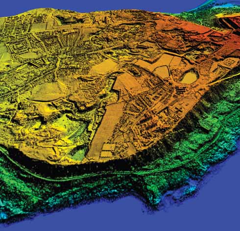
Airborne Laser Scanning (ALS, also known as airborne Light Detection and Ranging, LiDAR) is a means of creating detailed three-dimensional (3D) models of the Earth’s surface, known as Digital Surface Models (DSM) or Digital Terrain Models (DTM). The detail is sufficient to resolve buildings, tree, cars and even people. By convention cold colours (e.g. blues) represent low elevations and warm colours (reds) high elevations. Shading of the model, as if the sun were cast upon it, picks out all the small details.
ALS works in much the same way as RADAR and SONAR, in that it transmits a pulse, in this case of concentrated laser light, and waits for it to bounce off and return from the surface below the aircraft (usually a twin engine turboprop). This time delay allows us to calculate the distance from the aircraft to the ground. If we know the aircraft’s altitude this can be converted to give us the elevation of the surface above mean sea level (MSL). This technique gives us surface elevations to within 15cm (6”). The laser itself scans rapidly from side-to-side, whilst the aircraft flies forwards, meaning many pulses are sent and received every second and terrain models with a resolution of 25cm (10”) to 2m (6½’) are possible.
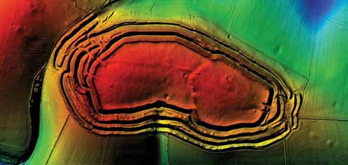
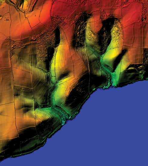
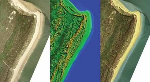
The measures of elevation are good enough to show subtle relief in the landscape, such as that from archaeological earthworks, geology and geomorphology. Everything from the patterns of sand dunes and their interrelationship with vegetation succession, through complex patterns of Iron Age hill fort ramparts to strip lynchets and medieval field boundaries are shown in great topographic detail and their precise size and shape can be measured. Even extremely small changes in relief come to light, even where you might not normally expect them.
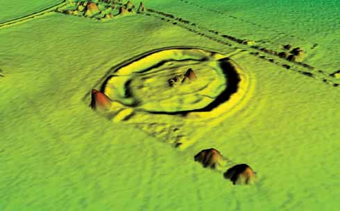
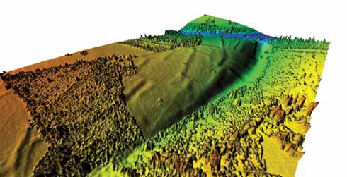
This technique works extremely well over open ground, as shown in the example of Knowlton Henge. However this isn’t always the case and other things get in the way. When flying over vegetation most of the laser pulses bounce off the leaves and branches, whereas fewer penetrate to the terrain below. Using computer algorithms the pulses from the terrain can be separated and used to make a 3D model. This allows us to reveal hitherto hidden terrain beneath woodland.
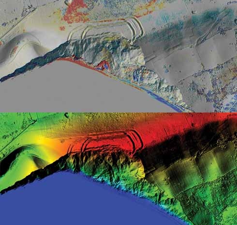
What is more, when repeat ALS surveys are conducted over time maps of differences can reveal what has changed and where. This is especially good for monitoring rock falls, landslides and the like and where our archaeology is under threat.
A good example of this is in the shot of Flowers Barrow Iron Age hillfort at Worbarrow Bay, where the red-coloured areas show spoil from rockfalls at the foot of the cliffs and the cool-coloured images show where the erosion has taken place.
Airborne Laser Scanning is also extremely good at revealing the morphology of settlements, which can be used for a myriad of different purposes, including the ability to precisely calculate which properties are in sight of new developments, and therefore how many individuals might be affected, or the optimum location for mobile phone masts or other telecommunications.
It is a technique for which there are many applications, but it is also one for which the county of Dorset might have been designed, with its mix of terrains, geological interest and archaeological heritage. ◗
